The Russian Navy’s new survey ship Yantar has been raising eyebrows in America and Europe, but not for conducting ground-breaking scientific research. The hi-tech ship, launched in May of this year, was designed by Almaz Central Marine Design Bureau in St. Petersburg and crossed the Atlantic in August, sailing past the Turks and Caicos Islands on 1 September, briefly stopping at Havana port on 4 September, then continued along the Cuban coast. In doing so, Yantar ruffled feathers at the Pentagon, passing close by / over the landing spot of an important communications cable connecting the American naval station at Guantanamo Bay to the US.

The Yantar’s movements have drawn comments from US officials who have been worried for months about the increase in tempo of Russian naval activities, particularly submarine activity near important cable exchanges. One European diplomatic source recently described the intensity of Russian submarine patrols as having risen by 50% in the past year and are “now at a level comparable to that of the Cold War.”
The Yantar, with two remotely operated vehicles (ROVs) capable of carrying out deep sea operations has cable surveying and cutting potential. According to the New York Times, “Cables carry global business worth more than $10 trillion a day, including from financial institutions that settle transactions on them every second. Any significant disruption would cut the flow of capital. The cables also carry more than 95 percent of daily communications.” The severance of a single major cable could cause billions of dollars of financial damage and majorly disrupt a wide range of communications.
Whilst it is common for cables to be damaged and severed by ship anchors, storms and natural disasters, breakages usually occur a few miles offshore and can be repaired in a few days. What particularly worries the Pentagon is that Russia appears to be probing for weaknesses in cable systems at much greater depths, a long way from shore, where a severance would be very difficult to repair. MarineTraffic data on the Yantar’s return transatlantic voyage shows the vessel spent nine days surveying a patch of the Atlantic over 1000km east of Grenada with depths ranging from around 2000m – 4000m.


The United States is of course no stranger to subsea cable operations and tapping. In 1971 the US Navy carried out Operation ‘Ivy Bells’ during which a modified submarine, the USS Halibut was sent into the Sea of Okhotsk acting on intelligence received about a Soviet communications cable. Divers working from the submarine found the cable and installed a 6m long device around the cable pipe that recorded all communications travelling through it. Today the USS Jimmy Carter is believed to carry out a great deal of undersea intelligence gathering.
Surveying, not spying?
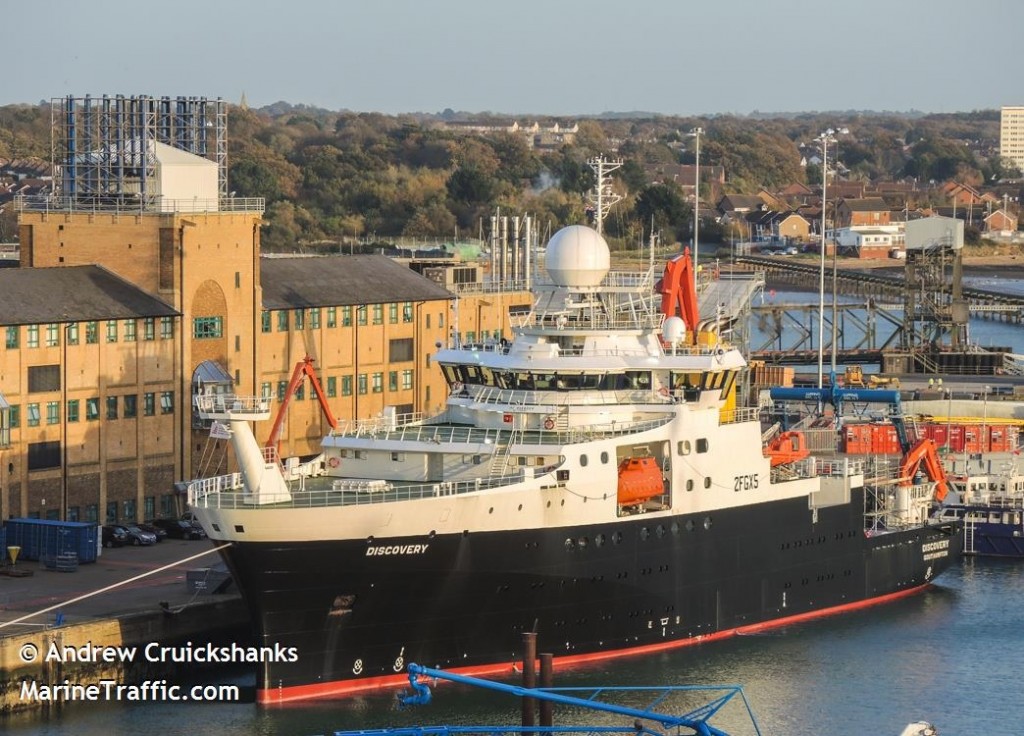
Survey ships come in a range of shapes and sizes and carry out a wide scope of work. Discovery pictured below was delivered to the UK’s National Environment Research Council (NERC) in July 2013 and has since completed nine scientific research voyages. At the time of writing, Discovery was south of the Canary Islands, destined for the Bahamas on a Rapid Climate Change Programme (RAPID) mission where it will collect data from NERC moorings in the Atlantic.
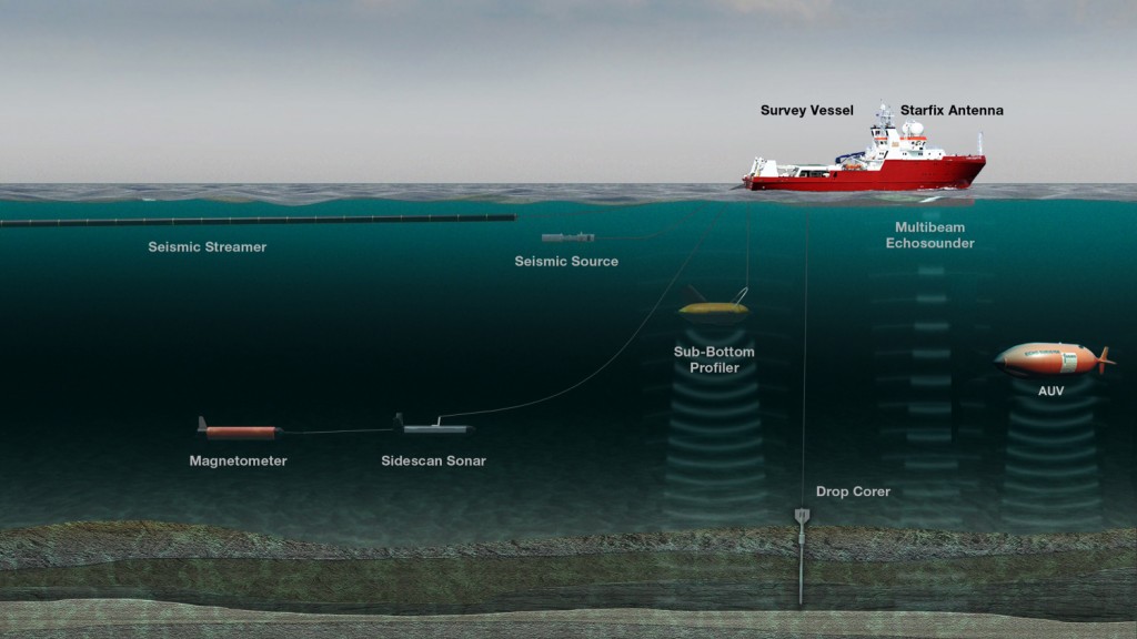
Survey ships also play a commercial role, with operators such as Dutch company Fugro running vessels which carry out surveys on behalf of energy companies. Advanced technology carried on-board survey ships includes multi-beam echo-sounders and sub-bottom profiler systems, enabling seismic surveys to be conducted. Visual representations of the sea floor and what lies beneath it can be created from data collected by seismic surveys. These in turn help geologists predict the location of hydrocarbons and direct exploratory drilling.
A detailed picture of the ocean floor can be of critical importance when working out the parameters and method for a search operation. For this reason, in June 2014 Fugro was awarded a contract by the Australian Transport Safety Bureau (ATSB) as part of the search for missing flight MH370. Advanced survey vessel Fugro Equator began mapping over 200,000 square kilometres of uncharted Southern Indian Ocean seabed using state-of-the-art multibeam echosounder equipment. The resulting bathymetric maps enabled a defined search for the missing aircraft to begin. In October 2014 Fugro Discovery commenced deepwater search operations, equipped with side scan sonar, underwater video and aviation fuel detection sensors.


 has been raising eyebrows in America and Europe, but not for conducting ground-breaking scientific research. The hi-tech ship, launched in May of this year, was designed by Almaz Central Marine Design Bureau in St. Petersburg and crossed the Atlantic in August, sailing past the Turks and Caicos Islands on 1 September, briefly stopping at Havana port on 4 September, then continued along the Cuban coast. In doing so,

